July 27, 2026
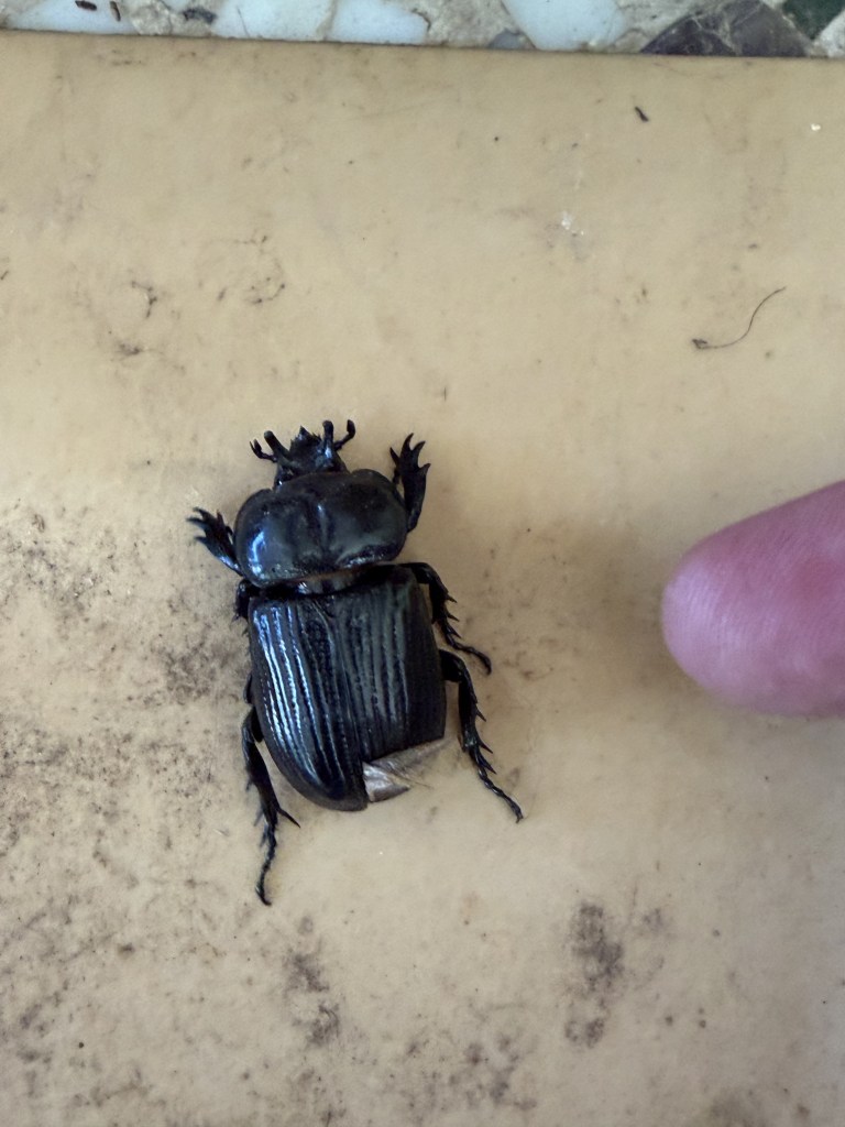
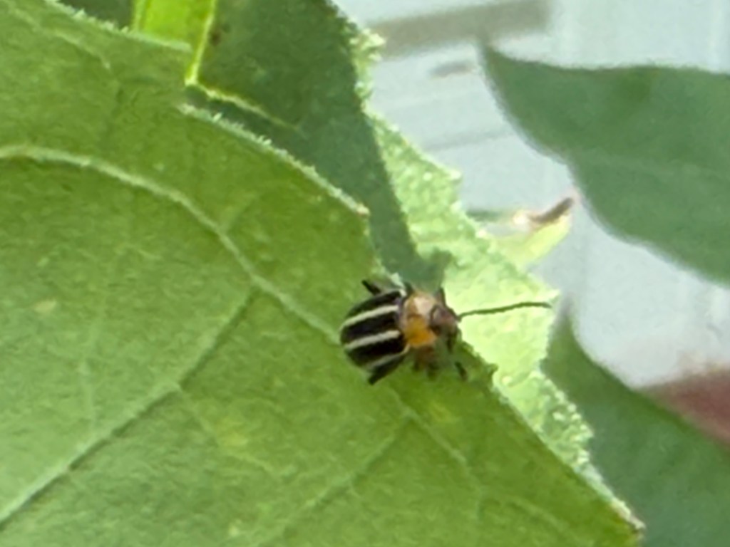
When I go out the back door it is always a mad scramble for the kids to race out into the yard. Sometimes I will stop at the door and hold up my hand (command to sit). Loki is usually reluctant but will slowly obey my command. Zena often instead crouches down a bit and whines in protest but will then sit. I did not require them to sit as I walked out to water the back garden today. When I opened the door there was the immediate scramble as each tear through the door, through the sun porch, and out into the yard, hoping to catch a slow gray squirrel (Sciurus carolinensis) on the bird feeders. As I walked out after them, I noticed they had both run over a large black bug lying on its back. It appeared to be in distress as its legs were flailing in an apparent attempt to right itself. As I was watching the bug the kids noticed me looking and came back to investigate. First Zena and then Loki came in through the door, and I had to shoo them away. I was reluctant to pick the bug up as I did not know what it was, so I swept it into a dustpan and turned it back onto its feet. After turning the bug over I recognized it as a triceratops beetle.
When I went online, I found the triceratops beetle (Phileurus truncatus) is a species of beetle of the family Scarabaeidae (scarab beetles). The beetle ranges across much of southern North America, up to the central south. It is known for its three horns present on both sexes. The name is a reference to the triceratops dinosaur (Ceratops horridus) that lived in the Late Cretaceous period (68 to 66 million years ago) on the island continent of Laramidia, now forming western North America. Adult beetles range from 1.25 to 1.5 inches (32 to 38 mm). Males have thicker, more blunt horns that curve more aggressively towards its body, while females have thinner, straighter, pointier horns. The horns have a divot running down the center of their prothorax dividing both sides, with a very small bump just before the divot. When they beetles are disturbed that produce sound (stridulations) by rapidly rubbing their hardened forewings against their abdomen.
The triceratops beetle is considered good for your yard and garden. As grubs, these beetles live inside rotting tree trunks (oak preferred) and consume the wood. After pupating into adults, they consume the grubs of other beetles. Hopefully this one has been feasting on the squash bugs that invaded earlier. I set the dustpan down and took a picture of the beetle. I had planned to safely release the triceratops back into the garden (and out of my house), but when I turned back to look, it was nowhere to be found. Our porch stores my bird and garden supplies, along with several hundred of Melissa’s succulents, and it apparently flew off and hid somewhere in the room. We keep the outside door open most of the time for circulation and we do have the occasional house sparrow (Passer domesticus) or paper wasp (Polistes dominula) that attempt to make this area their home. The triceratops might have done the same thing.
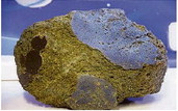
THOUGHTS: Having a triceratops beetle on our sun porch is not a bad thing, but I hope she (smaller horns) finds her way back outside. To my knowledge there are no beetle grubs living on the concrete floor. The ancient Egyptians revered another scarab beetle (Scarabaeus sacer) as a powerful symbol of rebirth, the morning sun, and creation. They connected the dung beetle’s habit of rolling a ball of dung across the sand to the sun moving across the sky. When young beetles hatched from the buried dung, the Egyptians saw it as a sign of life coming from nothing. When I visited the great pyramid at Giza there were several people selling terra cotta beetles with a bright blue glaze (faience). One gave a free beetle to each of the three ladies I was traveling with. After they walked off, he turned to me and said, “As you will.” They were gone and “free” beetles cost me US$1 (EGP51.37 Pounds) each. Another cultural lesson learned. Act for all. Change will come and it starts with you.