Monarch Pass

April 04, 2026

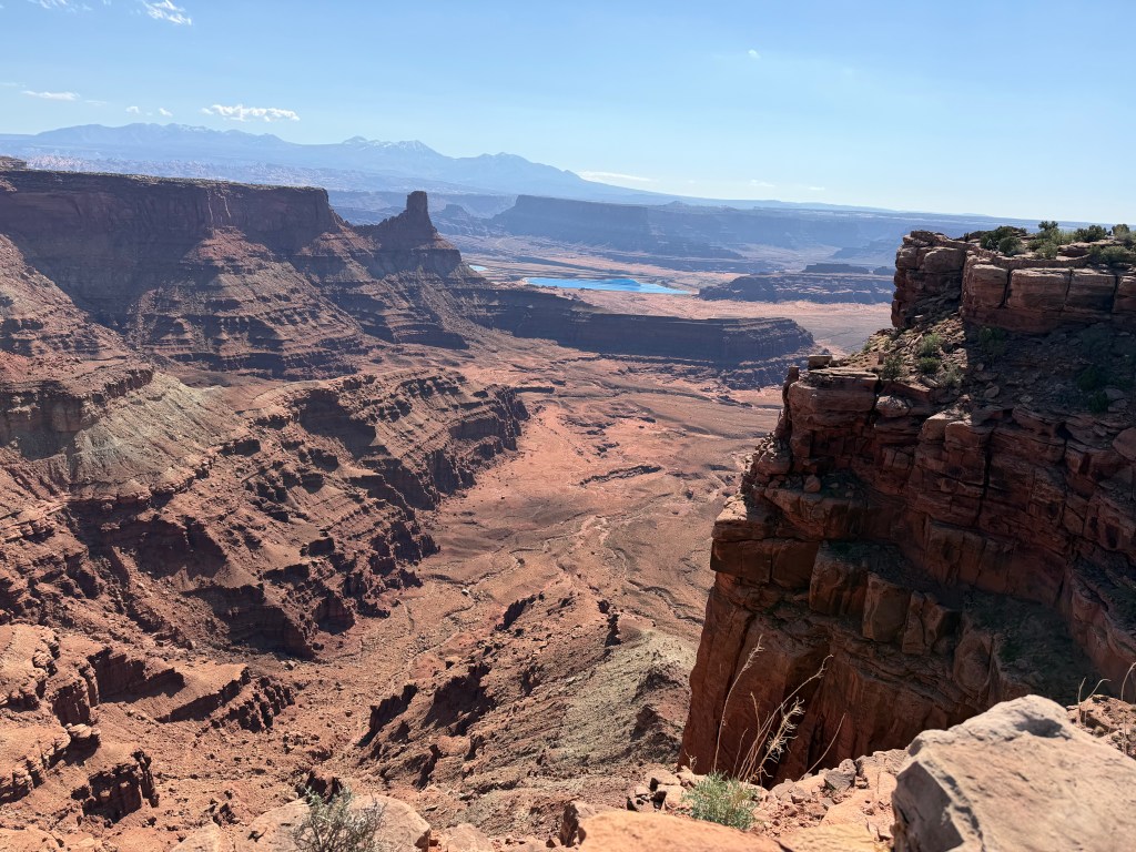
Our return from Utah took Melissa and I along the southern route through Colorado to avoid having to drive the steep passes of the central Rocky Mountains.  Melissa drove the 13 miles (21 km) of 6% grade on I-17 that drops into the Verde Valley and neither of us were excited about a repeat.  Things began as we took US Highway 50 out of Grand Junction, encountering rolling hills but nothing we could not handle.  Then we saw a sign that said Blue Mesa Summit (elevation 8,704 feet or 2,653 m) was just ahead.  The pass divides the watersheds of Little Cimarron River to the west and Blue Creek to the east.  This stretch is approximately 12 to 15 miles (19 to 24 km) long and has sections with grades of 6 to 10%.  Having ridden Verde Valley the previous week I was prepared for Blue Mesa and drove through without much concern.  I assumed we had made it through the lower Rockies, and I breathed a sigh of relief.  Little did I know looming 50 miles (80 km) ahead was Monarch Pass. 

When I went online, I found Monarch Pass (elevation 11,312 feet / 3,448 m) is a high mountain pass in the Rocky Mountains of central Colorado, US.  The pass is located on the Continental Divide of the western US at the southern end of the Sawatch Range along the border between Gunnison and Chaffee counties, approximately 25 miles (40 km) west of the town of Salida.  The pass carries US Highway 50 over the Sawatch Range providing a route between Tomichi Creek in the upper basin of the Gunnison River on the west and the South Arkansas River on the east.  The pass can be traversed by all vehicles under most conditions and is generally open year-round.  However, 7% grades exist and the area is prone to heavy winter snowfall which often results in temporary closures during severe winter storms.  The highway does have some three-lane sections and runaway truck ramps are located about halfway down both the eastern and western sides of the pass.  Ten curves have a 35 mph (56 kph) advisory speed and one 30 mph (48 kph).  The West Descent has a 6% grade for 9 miles.  The East Descent has a 6% grade for 10 miles.

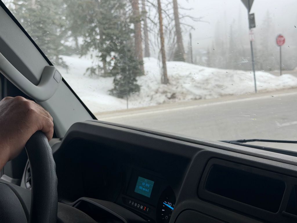
The climb up Monarch Pass begins at 8,184 feet (2494.5 m) and climbs over 3000 feet (914 m) to the summit with a steady 5-8% grade.  We were lucky enough to be traversing the eastern descent, so we got that extra mile (1.6 km) of steep grade.  Monarch Pass is rated as the #19 most feared road to drive in the US, especially during the winter due to heavy snowfall, strong winds, and several known avalanche areas.  The steep grades and sharp curves combine with a lack of shoulder or guard rails to make this route particularly hazardous.  As we neared the summit, we saw signs for “active snow removal” ahead.  The summit was covered in snow (thankfully not on the road) and a dense fog set in.  I did not know if that might be better as I could not see the drive awaiting us.  The fog lifted as we descended and Melissa looked out the side window into the 300 foot (91 m) drop to the trees below.  She kept her eyes directly ahead for the rest of the descent.  We crept down the mountain, only periodically applying the brakes.  A harrowing 25 minutes later we were down.

THOUGHTS: After Monarch Pass Melissa told me we are never going to take US Highway 50 again.  The problem is, unless you avoid Colorado entirely you will need to take some risk to cross the Continental Divide.  I had taken all these passes without incident when driving a car.  It was vastly different in a motor home towing our Jeep.  When we tried to find the number of annual fatalities on the road the site said, “it varied”, but they did occur “periodically”.  Spending six weeks driving 5000 miles (2495 km) across much of the southern US (Arizona to Florida) gave me a new perspective on the drivers that supply the US with 72% of domestic tonnage (11 to 13 billion tons/10 to 12 m tonnes) annually, valued at more than US$13 trillion.  These trucks do not stop on a dime, so give them a break.  Act for all.  Change is coming and it starts with you.

Moab

March 25, 2026

I moved to Salt Lake City in 1979 to attend graduate school.  I grew up in Kansas (various), and was used to living in towns surrounded by agricultural fields or the remnants of the big bluestem (Andropogon gerardi) that dominated the tall grass prairie.  What I found in Salt Lake was the Uinta Mountains on one side and a salt desert on the other.  While I quickly adapted to the mountains (skiing) I did not like the desert, finding it hot, salty, and barren.  After a few years I was drawn to the archeological sites of the four corners region and southeastern Utah (Anasazi cliff dwellings).  I later worked for the Division of State History mapping and encoding sites and participated in several archeological surveys in the area.  The more I worked in the area the more I was drawn to it.  By the time I left for California I found it was the desert I missed the most.  The largest city in the area at that time was the declining town of Moab with 4000 people.   

When I went online, I found Moab is the largest city and county seat of Grand County and is known for its dramatic scenery.  The population has risen from 4800 in 2010 to 5400 at the 2020 census.  Moab attracts lover 3 million tourist annually, mostly visitors to the nearby Arches (4 miles/6.5 km) and Canyonlands (22 miles/35.5 km) National Parks.  The town is also a popular base for mountain bikers who ride the extensive network of trails, including the Slickrock Trail.  Off roaders also come to for guided Jeep tours and the annual Moab Jeep Safari.  Moab has experienced a surge of second-home owners as the mild winters, and enjoyable summers attract people to the area.  This mirrors other resort towns in the American West and controversy has risen over the new residents and their houses, many of which are unoccupied most of the year.  Moab citizens are concerned the town is changing like the towns of Vail and Aspen in Colorado.  This means skyrocketing property values, a rising cost of living, and corresponding effects on local low- and middle-income workers.

I was anxious to revisit the quaint town of Moab and enjoy the solitude of the surrounding desert.  Melissa had been talking about visiting the area I loved ever since she heard stories of the many weekend trips taken by me and my son Alex.  Often, we would not see another human from the time we left the main road until we returned.  The desolation and isolation that had initially turned me off became the basis for my attraction.  What we found now was dramatically different.  Construction started several miles outside of town, with light industrial sites, gas stores, and fast-food chains.  These were interspersed with motels, residences, and RV parks.  The street was lined with businesses offering scenic tours by jeep and mountain bike.  If you did not want a tour, you could rent either to go on your own.  There were offers for ziplines along the canyon rim and plane rides.  What struck me most was the change from quiet isolation to the hundreds of people walking or biking along the main throughfare.  While the residents may be only 1500 more than I remembered, tourists overwhelmed the city.  Moab embraced the niche market of adventure tourism. 

THOUGHTS: Melissa and I camped our RV about 15 miles (24 km) north of Moab in the new (2021) Utahraptor (yes, found there) State Park.  This was centrally located to spend time at two sites I fondly remember, Dead Horse Overlook and Arches National Park.  We found Arches often has long wait lines to enter (exceeding 60 minutes from spring through fall) and the park temporarily restricts access if parking lots fill up.  We opted to go straight to Dead Horse.  Here again we found 100’s of people.  Most were hiking or mountain biking the roads and trails that wind through the park.  My recollection was seeing one or two other cars at the overlook.  While you can go home again, it may not be recognizable.  Still, the trip was worth it and the scenery spectacular!  It was worth the crowds.  Act for all.  Change is coming and it starts with you.

Burros

March 19, 2026

Several days ago, we camped in the Homolovi State Park in Winslow, Arizona.  I was excited to camp in the park as it contains the remains of two pueblos along with a petroglyph panel.  Homolovi now serves as a center of research for the late migration period of the Hopi from the 1200’s to the late 1300’s.  The park is over 4000 acres (1618.74 ha) and includes a visitor center and museum, various trails and the campground where we spent the night.  We arrived early as I wanted to explore the ruins and walk the trails.  As we entered the gated park, we saw a sign indicating it was an open range (animals roam free inside the fenced area).  We explored the partially excavated Homolovi II site and then took the kids for a walk around the parking lot.  The docent at the museum had shown me where the petroglyph (pecked rather than drawn) panel was located and that became our second stop.  On the way to the ruin, we noticed several animals grazing off in the brush.  On our return the animals had moved closer to the road, and we saw they were wild burros. 

When I went online, I found Wild burros (Equus asinus) in Arizona are primarily found in the western desert mountains, most famously in the historic mining town of Oatman, where they roam freely and interact with visitors.  The burros are descendants of 19th-century mining pack animals.  The protected animals can also be found near Lake Pleasant, near Peoria, Arizona.  While the burros are a popular attraction, they are wild.  They can bite or kick and feeding them is discouraged to protect their health and safety. The burros are often found in various Bureau of Land Management (BLM) areas in western Arizona and are particularly active during early morning and late afternoon.  There are over 10,000 estimated wild burros in Arizona, which is far above the sustainable level for the environment (less than 1,500), leading to BLM efforts to manage the population and reduce their impact on the desert.  The burros are protected under the federal Wild and Free-Roaming Horses and Burros Act (Public Law 92-195) of 1971, which means it is illegal to harass or harm them.  BLM suggests the best way to see the animals is from a distance, without pulling off the road.

While the burros we saw at Homolovi were from a distance, we found them close when we arrived at our Lake Pleasant campground.  There was a group of three who were feeding among the campers across from where we were assigned.  I had been wary of camping at several of the “Horse Motel” campgrounds set up to accommodate equestrian travelers along our route as I was unsure how the kids would react to the large animals.  Now I had no choice as we were invading their protected land.  We kept the kids inside while we set up camp and placed the night shade over the front windshield of the RV.  I checked outside before taking the kids for a walk to burn off energy before feeding them.  We all settled in together inside the RV as it was too hot to be outside.  Later that evening I put on their lease to take them out for a final trip.  I always go out before them to make sure I have control of the lease.  When I opened the door, Zena nearly knocked me down as she tore through the opening with her VERY loud protective bark.  One of the burros was standing about 15 feet (3 m) from our front door.  I do not know who was more surprised, the burro, the dogs, or me.   

THOUGHTS: While wild burros are predated by mountain lions, this is not enough to keep their population in check.  The Wild and Free-Roaming Horse and Burro Act charged BLM with managing wild burros in a thriving natural ecological balance with other plants and animals to maintain healthy ecosystems.  Wild burros removed from management areas due to overpopulation, emergency situations, or through nuisance are available for adoption through the BLM’s Wild Horse and Burro Adoption Program.  Protecting an invasive species is always a fine line.  Act for all.  Change is coming and it starts with you.

Verde Valley

March 18, 2026

After battling the winds across the Panhandle region, we were home free as we climbed into the Ponderosa pine (Pinus ponderosa) forest that surrounds Flagstaff, Arizona.   The Coconino National Forest is located within the world’s largest contiguous Ponderosa pine forest (yes, where the name Ponderosa Ranch comes from on the long-running TV series Bonanza).  These dominant, tall trees are famous for their orange-brown, puzzle-like bark that smells like butterscotch or vanilla.  We also passed three National Monuments along the route that were extant cliff dwellings of the prehistoric Ancestral Puebloans (Anasazi).  Like so many other first-time travelers to Arizona, we were surprised to find the dense forest of the Kaibab Plateau rather than the stark desert we associated with the state.  As we traveled south out of Flagstaff the forests diminished and the saguaro cactus (Carnegiea gigantea) took over as we began to drop in elevation.  The saguaro is the largest cactus in the US and acts as a vital, long-lived (up to 200 years) keystone species in the Sonoran Desert.  While I had anticipated the saguaro, I was not prepared for the Verde Valley descent.    

When I went online, I found the steep grade on Interstate 17 descending from Flagstaff toward Phoenix is often referred to as the Verde Valley grade or simply the I-17 mountain corridor.  This stretch includes a sustained 6% grade for roughly 13 miles (21 km) between Flagstaff and Camp Verde, Arizona that requires runaway truck ramps.  The stretch also includes another steep section for southbound traffic near Black Canyon City.  The route is known for high speeds, steep inclines, and sharp curves and is often cited as one of the most treacherous connections in Arizona.  While Flagstaff sits at 7000 feet (2133 m), Phoenix rests in the Verde Valley at an elevation of 1,086 feet (2133,6 m).  Although only 145 miles (233 km) apart, the great difference in elevation result in drastic climate changes.  Flagstaff is typically 20F to 25F degrees (36 C to 45C) cooler than Phoenix on any given day all year round.  This was a descent we were unprepared for.

Our first indication of the Verde Valley downgrade was a sign saying, “6% grade ahead.  Trucks and vehicles towing trailers use lower gears.”  We were driving the RV and pulling our Jeep behind.  We qualified for the warning.  My first thought was I was glad I was not driving.  Then, I wondered if I should offer to drive.  Neither of us had driven anything close to these conditions, so I was not sure I could do anything better than Melissa.  Instead of pulling over, Melissa asked for suggestions on how to drive.  She slowed down and I clicked on the emergency flashers as we began our descent.  The first thing we tried was shifting into 2nd gear.  That did not last long as the engine RPM climbed close to the red line.  I had just read an article online about the best way to slow your RV when on a steep grade and it suggested to make hard brakes followed by taking your foot off the brake.  Melissa shifted into Drive and periodically punched the brake to slow down.  There were also reprieves on the descent where it would level off or even ascend for short distances.  Melissa did a great job, and we got down without incident.

THOUGHTS: Toward the end of the Verde Valley descent, we passed a truck parked along the side of the road with its brakes smoking.  I was glad the driver was able to stop (and that we had avoided a similar situation).  I was also proud of the way Melissa had handled driving.  It was tense for me, and no doubt more so for Melissa.  I knew we had to retrace this route on our way to Utah, but this time we will be going up, a whole new set of problems.  This last month has been an amazing immersion into the diversity of the US.  We traveled from the Ozarks to the Florida Atlantic coast, then to the high plateau and desert of Arizona.  The people have been just as diverse.  Rather than a detriment, diversity is what defines our nation.  Act for all.  Change is coming and it starts with you.

Astoria

February 16, 2026

Scrolling the NY Times Headlines feed, I came across a bird who has captured the attention of New Yorkers.  The bird arrived in Manhattan’s Battery Park and eventually settled in the area near the Sea Glass Carousel, just north of the Staten Island Ferry terminal. Three human women have become her self-appointed caretakers and visit her daily.  New Yorker’s regularly fall in love with celebrity wildlife, including unusual ducks, a pair of coyotes, and Flaco the escaped owl in Central Park.  Sunny Corrao, the deputy director of the city parks department’s wildlife unit, said, “She’s the only known turkey in Manhattan, “but this is not unusual.”  A turkey was known to hang out in Inwood Hill Park in Upper Manhattan in the past and there are large flocks in the Bronx and on Staten Island.  Smaller groups come and go to Queens and Brooklyn.  Astoria got her name because she was first spotted in Astoria, Queens, before making her way to Roosevelt Island and, finally, Manhattan.

When I went online, I found Astoria is a descendant of the wild turkey (Meleagris gallopavo) first domesticated in Pre-Columbian Mexico.  The Classical Nahuatl word for the turkey (huehxōlō-tl) and the Spanish guajolote are still used in modern Mexico.  Mayan aristocrats and priests had a special connection to turkeys, with ideograms of the birds appearing in Mayan manuscripts.  Spanish chroniclers Bernal Díaz del Castillo and Father Bernardino de Sahagún describe the multitude of food (both raw fruits and vegetables and prepared dishes) offered in the vast markets (tianguis) of Tenochtitlán, noting there were tamales made of turkeys, iguanas, chocolate, vegetables, and fruits.  Turkeys were first exported to Europe via Spain around 1519 and gained immediate popularity among the aristocratic classes.  English settlers brought turkeys to North America during the 17th century.  There were an estimated 10 million turkeys in the US during the 17th century, but by the 1930’s only 30,000 remained.  In the 1960’s and 1970’s, biologists started trapping wild turkeys and re-introducing them into other states. 

The three self-appointed caretakers of Astoria coordinate their schedules in group chats and text messages, sharing photos and updates on Astoria’s location and condition.  Keiko Komiya visits the turkey in the morning, and Stella Hamilton and Anke Frohlich are generally there in the afternoon, and for bedtime.  Astoria spends her days strutting around on the ground, then every evening (at 20 minutes after sunset) she flies up into a tree to spend the night.   Hamilton is a retired nurse and birder who was previously a big fan of Flaco, the Eurasian eagle owl set free from Central Park Zoo.  Komiya is an English student and avid birder whose first New York City celebrity bird was the mandarin duck she photographed daily in 2018.  Frohlich started photographing birds during the covid-19 pandemic and runs an alternative healing practice in Greenwich Village which allows her to give the birds priority.  The women do not worry about Astoria, but everything and everyone else.  Young kids chase her, dogs scare her, and people press on her for selfies.  Astoria also crosses State Street to bask in the warmth emanating from the Starbucks on the corner and the friends fear she will be hit by a vehicle.  Their fears are not unfounded.

THOUGHTS: While Astoria has grown a devoted fan club, she is not the only wild Turkey residing in New York.  “New York City is actually great habitat for a wild turkey,” Jessica Wilson, the executive director of NYC Bird Alliance, said. She noted that the birds are native to the area, have plenty to eat here and do not necessarily need turkey friends.  “They often join flocks, but they also are fine on their own — and in general, we try not to interfere with their social life.”  Perhaps we should treat people with the same respect.  Act for all.  Change is coming and it starts with you.

DET

February 14, 2026

I found it appropriate that in the middle of the Great Backyard Bird Count 2026 (February 13 to 16, 2026) that my Sunday paper (delivered on Saturday) would have a USA Today article on an annual lottery for the bald eagle tour in Monroe, Michigan.  There were approximately 1,200 entries for this year’s 30 lottery winners and their guests.  “It’s the largest number since the event began in 2008.  It shattered our previous record,” said Maddie Drury, park ranger with the US Fish & Wildlife Service who sponsors the tour.  Winners were driven out to the wooded area on the south end of the power plant, where Plum Creek and the power plant’s warm water discharge meets Lake Erie.  In winter the warm water draws fish, and the fish draw predators.  Amanda Schaub, communications strategist for the plant said, “Consistent with our Michigan Public Service Commission approved plan, the plant is scheduled to retire in 2032.”  DET Energy is committed to working closely with the community as they plan for the site’s future.

When I went online, I found several endangered or rare species have a home at the Detroit Edison (DTE) power plant facility.  Since the mid-1990’s, DTE Energy has supported peregrine falcon (Falco peregrinus) reintroduction and breeding programs in southeastern Michigan and near their power plants.  Employees assist with banding, tracking and rescuing at-risk chicks. Peregrines have been recorded nesting on the Monroe Power Plant grounds since 1994.  Over 100 adult and juvenile bald eagles (Haliaeetus leucocephalus) have been counted near the shoreline at the Monroe Power Plant and nest regularly at the Fermi 2 Power Plant.  Apprentice linemen install utility poles in various bird projects, such as eagle habitat at the Lake Erie Metropark and Humbug Island within the Detroit River International Wildlife Refuge, as well as a great blue heron rookery at Lyon Oaks County Park.  These projects foster the bird population while giving apprentice linemen experience in installing tall poles without energized lines or power transmission equipment.

The DET Monroe Power Plant is home to other endangered species.  The American lotus (Nelumbo lutea) is listed as a threatened species in Michigan.  The plant naturally cleans the water in which it lives, which is important for the native fish and wildlife.  In partnership with the Lotus Garden Club of Monroe, DTE Energy opens the Monroe Power Plant property for guided tours of the flowerbeds.  Lake Sturgeon (Huso fulvescens) are the longest-living fish species in Michigan, with a lifespan of up to 100 years.  They can be over eight feet (2.5 m) in length and weigh 800 pounds (363 kg).  Sturgeons are listed as threatened or endangered by 19 of the 20 states within their original range in the US.  DTE deposited 765 tons (694 mt) of coal cinders (a byproduct of coal combustion), cobble and broken limestone in the Detroit River off Belle Isle to create spawning beds.  Common Terns (Sterna hirundo) once numbered in the thousands along the Detroit River but now only 250 breeding pairs can be found there.  DTE Energy partnered with others to create an artificial nesting island and nesting habitat.

THOUGHTS: Drury, who is based at the Detroit River International Wildlife Refuge in Trenton, calls bald eagles the “most successful conservation story of the US”.  For decades the insecticide DDT was widely used to kill insects.  Fish ate treated vegetation, birds ate the fish, and affected bald eagles laid fewer viable eggs.  In 1963, the continental US had just 417 mating pairs of bald eagles.  DDT was banned in 1972, and the eagles have bounced back.  In 2007, the US had 9,700 bald eagle mating pairs, and the bald eagle was removed from the endangered list.  By 2020, there were 71,000 breeding pairs.  The lottery for the DET Monroe Power Plant eagle tour typically opens right after Thanksgiving.  Act for all.  Change is coming and it starts with you.

Birds 2025

January 31, 2026

Today’s local newspaper (“Sunday”) ran a front-page story on how the cold weather is prime birding season around back yards and feeders.  This reminded me that I am even later this year in reporting my annual birding totals.  Once again, I saw several red-tailed hawks (Buteo jamaicensis) on the power lines going to and from town but was unable to get a picture, so they were not added to my count.  While I was able to take my usual trip to the wildlife area this year and did record five different species (long range).  However, the lighting was so bad I was unable to identify any but the wild turkey (Meleagris gallopavo) flock I noticed while trying to capture several deer (again long range) in a filed.  Another miss.  The end-of-year presence on my feeders was good as the cold weather brought the sparrows (genus, Passer), along with house (Haemorhous mexicanus) and purple (Haemorhous purpureus) finches.  The northern cardinals (Cardinalis cardinalis) did come back in mass but I saw only one or two blue jays (Cyanocitta cristata).  I have yet to clean out the bluebird (Sialia sialis) house but have seen the sparrows nosing around the entrance so I will need to get rid of the old debris for this year’s nesting.

All that said leads to my “great reveal” concerning my birder totals for 2025.  The number of feeders has fluctuated throughout the year as I began with 12 feeders offering different types of food.  The squirrels (Sciurus carolinensis) and grackles (Quiscalas quiscula) managed to take out my camera feeder, and the finches have all but abandoned the thistle seed feeder for some reason.  I also switched to safflower kernels rather than black oil sunflower in my two window feeders hoping to discourage the squirrels (it sort of works).  That leaves me with 9 active seed feeders to go along with the 9 hummingbird feeders.  Now, on to the results.  You may recall I recorded 26 species in my first year (2020), ended with a high of 52 species in 2021, dropped to 44 species in 2022, a low of 30 species in 2023, and then rebounded to 39 species in 2024.  During 2025 I was able to rise a little higher and recorded 44 different species.  My European sightings happened again as we took two trips, one to the Greek Isles (9 birds) and another up the Danube River (8 birds).  The bus ride to the Neuschwanstein Castle (Disney’s type site for his princess castles) also yielded 4 different species of raptors, but I was unable to document them.

Most of my sightings have been limited to the immediate area, but we are planning to expand that during 2026.  We are taking the RV along the interior to the Atlantic side of Florida and then back along the Gulf of Mexico as our return.  This will hopefully produce some new shore bird sightings.  We are then driving across Oklahoma to Arizona with a return through Utah.  This should record a few species of desert birds.  Then we are scheduled for an Alaskan cruise in June which should score some Pacific birds.  I am hoping between our trips I can raise my totals (and overall species count) to new levels this year.  We will see.

THOUGHTS: I am looking forward to participating in the Great Backyard Bird Count 2026 again this year.  The 2025 count had hundreds or thousands of people from all over the world and found 8,078 species of the world’s known species, or 158 more than in 2024.  Be sure to mark your calendars for the Great Backyard Bird Count 2026 (February 13 to February 16, 2026).  You can sign up and find how to participate at https://www.birdcount.org/participate.  Once again, birds are the (literal) canary in the mine shaft (earth) when it comes to gauging the health of our ecosystems.  Act for all.  Change is coming and it starts with you.

Bustards

January 30, 2026

WAY down on my MSN browser I came across an article on an invasive species that is disrupting the fragile ecosystem of the Desert National Park (DNP) in Rajasthan, a state in northwest India.  Hybrid pigs, from wild boar (Sus scrofa) and domestic pig (Sus domesticus), appeared in the park after a canal project brought in permanent water sources and crops, turning the arid desert into a pig haven.  In the past two decades the invasive species have become opportunistic predators and competitors endangering local plants and animals.  Manas Shukla, a wildlife researcher at the DNP, said, “The invasive pigs are becoming a major competitor of threatened vulture populations over food that can further impact these declining species.”  Farmers have reported crop damage, attacks on livestock, and even humans.  Bustards (Family, Otididae) and vultures (Family, Accipitridae) are also at risk, as the pigs eat the eggs of ground-nesting birds and the carcasses eaten by the scavengers.

When I went online, I found Bustards are a family of large, terrestrial birds living mainly in dry grasslands and steppe regions.  The word bustard comes from the Old French “bistarda”.  The naturalist William Turner listed the English spelling as both “bustard” and “bistard” in 1544.  All the common names are derived from Latin avis tarda or aves tardas given by Pliny the Elder.  The word tarda comes from tardus (Latin, “slow” and “deliberate”), which aptly describes the species’ typical walking style.  The two largest species of bustards, the kori bustard (Ardeotis kori) and the great bustard (Otis tarda), are frequently cited as the world’s heaviest flying birds.  Males can exceed 44 pounds (20 kg), and average around 30 pounds (13.5 kg), with a length of 59 inches (150 cm).  The smallest species is the brown bustard (Eupodotis humilis), which is 16 inches (40 cm) long and averages 1.3 pounds (600 g).  Bustards are among the most sexually dimorphic groups of birds with males often 30% longer and sometimes more than twice the weight of females.  Bustards are omnivorous and opportunistic, eating leaves, buds, seeds, fruit, small vertebrates, and invertebrates.

Forest officials have removed the pigs from bustard enclosures but have yet to enforce large-scale control measures due to wildlife protection laws.  Researchers argue that the invasive pigs are not native wildlife and should be controlled or translocated to protect the local ecosystem.  Human intervention, like building infrastructure or bringing in artificial water sources, changes ecosystems to unintentionally favor invasive animals.  Native populations decline because the ecosystems have changed and allowed invasive species to proliferate.  About 2 in 5 threatened or endangered species are at risk due to invasive species, according to the National Wildlife Federation.  Invaders bring harm by outcompeting, preying on, and spreading diseases, along with disrupting food chains, and destroying habitats.

THOUGHTS: Like the threat to the Bustards, human activity can bring invasive species to new environments.  Travel and trade transport species but changing land use can also allow them to move and prosper.  Converting land for agricultural use opens it to exploitation from invasive species.  The United Nations shared that human activity has already altered approximately 70% of the world’s ice-free land, and often in ways that unintentionally reshape local habitats.  Many of the world’s creation stories place humans as the caretakers of the world rather than exploiters of its resources.  Ignorance (or apathy) can no longer be an excuse for destruction of the environment.  Act for all.  Change is coming and it starts with you.

Get Out

January 27, 2026

Last weekend we had a major winter storm that spread across the US that affected multiple states and resulted in freezing temperatures and heavy snow.  The storm was predicted to hit our area around 9 p.m. CST Friday and when we checked the snow was just starting to fall.  We got 4 inches (10 cm) of snow Friday night, followed by 4 inches (10 cm) of sleet/ice on Saturday, then topped by another 3 inches (7.5 cm) of snow early Sunday.  I had been clearing off the ramp from our back door and spreading a pet friendly deicer during each break so it was clear, allowing me to get out to fill the bird feeders and the kids could make it to the side yard.  While the storm had passed by Sunday afternoon, our back patio (and the roads) had become a 5-inch (12.5 cm) slab of ice.  ARDOT (state transportation) warned people to stay indoors to avoid the treacherous conditions and to stay out of the way of the emergency crews trying to clear the roads and restore power.  Melissa and I both took the warning and decided this was not a good time to get out.

When I went online, I found the storm brought power outages and treacherous road conditions across the South and Northeast and allowed few people to get out. The treacherous conditions have so far been linked to 34 deaths in 14 states, including two in Arkansas.  The Associated Press news agency reports that the storm has been linked to the deaths, with causes ranging from hypothermia to weather-related traffic, sledding, and snow plough accidents.  The Arkansas deaths were both linked to improper use of an ATV.  The storm brought dangerous winter weather conditions, including ice and freezing rain, leading to widespread travel disruptions and emergency declarations in affected areas.  The precipitation was compounded by overnight temperatures that dropped into single digits (F) and never climbed above freezing (32F/0C) during the day.  Schools, governments, churches, and businesses were all closed over the weekend and are only beginning to open today. 

Today marked the fourth straight day in isolation and both the kids and us were needing to get out of the house.  Since it was going to climb into the 40’sF (4.5+C) by afternoon we all made a break for it.  I knocked the remaining 3 inches (7.3 cm) of ice off the Jeep and put the crankcase in 4-high.  We struggled to get over the ice dam surrounding our vehicle, but a little extra gas got us over the top.  The cul-de-sac and street leading to the town’s main throughfare were all packed with snow, but once out of our subdivision the main road was wet but not slick or icy.  We took the kids to the lake where we walked, and it was packed with snow as well.  Melissa asked me to cut a few “doughnuts” and then I drove out on the spits to see what conditions could be to walk tomorrow.  I immediately slipped when I got out and realized I would need to wear my crampons and not stay out too long if we walked at all.  Still, it was good to get out to reacquaint us with the world. 

THOUGHTS: I always saw the irony of snow days in school as what they really did was allow students to get out and play in the snow.  One of my fond memories as a child was the winter when my brother and I built snow caves in the drifts along the side of the church.  Then in my senior year in high school when the town shut down and my friends played tackle football in the snow (could not go fast) and then went to a park and played duck-duck-goose in the fresh powder.  Being a January baby, I have always liked snow and did not mind the freezing weather.  I must admit, the cold is only fun if you are able to dress warmly.  Hypothermia, frostbite, and even death can come quickly in fridged conditions.  Thankfully, several area agencies open “warming stations” when the temps drop below freezing.  Most of the 34 deaths were people unable to find warmth.  We cannot let unhoused become uncared for.  Act for all.  Change is coming and it starts with you.

Ash Borer

January 12, 2026

Yesterday’s local newspaper carried a USA Today article on a project designed to restore native ash populations to the state of New York.  The ash saplings planted at Cornell Botanic Gardens as part of the Nature Conservancy’s Trees in Peril project are part of an effort to restore the disappearing species.  Ash has long been valued for its lumber and is used in baseball bats, tool handles, flooring, and fireplaces.  The invasive species attacking the trees was first discovered by entomologist Mike Griggs on Cornell University’s campus, as tree canopy dieback, yellowing and browning of leaves.  The condition had spread farther west in the state in 2009, and quarantine zones were established in 2015 to block the spread.  Accord­ing to the NY State Department of Environmental Conservation, the emerald ash borer has killed millions of trees across the US, caused billions of dollars in damage and loss, and overtaken virtually all of New York state.

When I went online, I found the emerald ash borer (Agrilus planipennis), or EAB, is a green jewel beetle (buprestid) native to north-eastern Asia that feeds on ash species (Fraxinus spp.).  Adult beetles are typically bright metallic green and about 0.33 inches (8.5 mm) long and 0.063 inches (1.6 mm) wide.  Emerald ash borer is the only North American species of Agrilus with a bright red upper abdomen when its wings are spread.  The species has a small spine at the tip of the abdomen, and saw-like (serrate) antennae that begins at the fourth antennal segment.  Females lay eggs in bark crevices on ash trees and the larvae feed underneath the bark to emerge as adults in one to two years.  The ash borer is typically found at low densities in its native range and does not cause significant damage to trees but is a highly destructive invasive species to the ash trees of Europe and North America.  Adults prefer to lay eggs in stressed ash but readily lay eggs in healthy trees among other tree species.  Little was known of the ash borer before it was found in North America. 

Local governments are attempting to control the ash borer by monitoring its spread, diversifying tree species, and using insecticides and biological control.  A significant discovery was made by the US Forest Service when they found relatively healthy trees amidst a forest of dead trees.  The surviving trees, called lingering ash, could serve as a catalyst for repopulating ash populations across the US.  The ash borer larvae tunnel through the living tissue and with 100’s of 1000’s of insects in each tree can essential girdle the tree making it impossible to transport resources between the canopy and roots.  Researchers found some lingering ash can “wall off” the larvae and prevent the insects from girdling the tree.  A second possible defense is related to the organic compounds emitted by ash trees during photosynthesis and used by the ash borer to detect the trees.  If an individual tree does not produce those chemicals or does so at low levels, the tree becomes “invisible” to the insects.  The goal of the project is to propagate 50 to 60 genotypes of trees of each of the three ash species (white, green, and black).  In 5 to 6 years cuttings (scions) will be collected and the process repeated.  The lingering ash will then be planted among susceptible trees to restore ash to the forest environment.

THOUGHTS: The Emerald Ash Borer likely arrived in North America from Asia in the 1990’s hidden in solid wood packing materials (crates and pallets) used in cargo ships.  Detection in the US was in Michigan in 2002.  This accidental introduction allowed the invasive beetle to spread rapidly, killing millions of ash trees.  Movement of infested firewood by humans accelerated its spread across the continent.  The predators and diseases that naturally keep the ash borer in check do not exist in North America.  Developing the lingering ash would be a significant check on yet another invasive species.  Otherwise, Major League Baseball will be forced to use aluminum bats.  Act for all.  Change is coming and it starts with you.